Vietnam’s construction industry adopts geospatial technology
By Quynh Chi
September 16, 2020 | 04:12 PM GMT+7
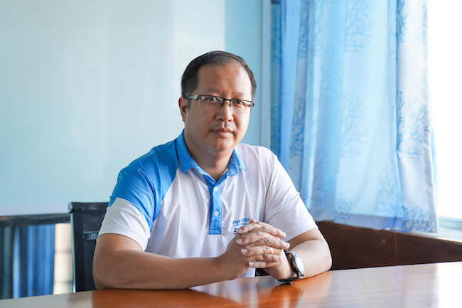
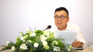
Dr. Hoang Hiep, Portcoast team leader of the project on Hyosung Vina chemicals port says that two pivotal factors contributing to work construction’s digitalization are laser scanners and people.
3D laser scanning devices are used in the Hyosung Vina chemicals port project
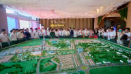
The Hyosung Vina chemicals port in Ba Ria-Vung Tau province is a collaboration between the Vietnamese Government and South Korean industrial conglomerate Hyosung Corporation that is estimated to contribute $80 million annually to the state budget.
It is part of the Hyosung Chemical Complex, which includes a propane dehydrogenation (PDH) production plant, a polypropylene (PP) plant, a liquefied petroleum gas (LPG) storage tank and an LPG and petrochemical product.
Construction of the massive project began in 2018 and was completed on March 3, 2020. One of the final tasks in constructing the port was the LPG jetty, which was handled by Portcoast, Vietnam’s leading port and coastal survey consultants with over 30 years’ experience in marine, waterway, and transport infrastructure.
TheLEADER talked with Dr. Hoang Hiep, the Portcoast team leader of the project, about how geospatial technology changed the way they conducted their work.
Nowadays, digitalization is talked about a lot in different fields. So how is digitalization in construction taking place?
Dr. Hoang Hiep: It's undeniable that digitalization is of paramount importance these days. It is implemented in two most common methods: graphic/space data and semantic/topological data.
As for graphic/scale data, we optimize the use of 3D laser scanners to digitalize the work surface’s current status. Regarding semantic/topological data: all documents related to the work construction will be digitalized by specialized applications and scanning devices.
What are important factors in order to successfully digitalize construction industry?
Dr. Hoang Hiep: The two pivotal factors contributing to work construction’s digitalization are the laser scanners and the people. In particular, the ability of 3D laser scanning devices such as accuracy, point cloud density, scanning range is the integral factor exerting in the quality and accuracy of survey data. The data processing and 3D BIM modeling according to the scanned data is based mostly on the skills and abilities of the engineer.
Could you please share more about the process of human resource training to be able to implement such complex project as Hyosung Vina Port?
Dr. Hoang Hiep: In terms of our human resources, the project’s engineers are our permanent staff from different departments, such as surveying and designing. At the initial phase, we invited top-flight connoisseurs working for the suppliers of equipment and software to provide us with specialized training in using this cutting-edge technology.
Upon finishing the training session, we self-trained and gained hands-on experience throughout the construction works. As regards the 3D laser scanners and geodesic equipment, our surveyor engineers will be the primary focus in utilizing them. On top of that, our civil engineers will engage in the process of building BIM models.
However, because Hyosung Vina Port is a challenging project that integrated various modern equipment that has never been used in Vietnam or South East Asia before, we simultaneously had to self-study, worked, and asked for experts’ technical support from the equipment suppliers.
Whatwas Portcoast’s role on the project?
Dr. Hoang Hiep: As the consultant for the project, we were involved starting from the first package of the reclamation work for the new port. We created the 3D mapping for the topographic survey, the as-built model of the LPG jetty and facilities, and conducting the inspection report for the revetment protecting the jetty. Portcoast started using Leica Geosystems’ products in November 2019 for this project.
Dr. Hoang Hiep, the Portcoast team leader of the project on Hyosung Vina chemicals port
The topographic survey covered an area of over 5 hectares – and with much of the area located in the water, Portcoast’s level of specialist knowledge and experience was essential for collecting data in these hard-to-reach areas. To compound the inaccessibility challenges, while some areas of the complex were still under construction, others were already operational.
Whatwas the biggest challenge involved in scanning the port?
Dr. Hoang Hiep: The main challenge was the selection of scanning positions in a complex with significant traffic, where disturbances from the ongoing construction work could compromise the stability required for precision scanning. To mitigate the challenges of working in this disruptive, heavy traffic environment, we decided to conduct the scans from elevated locations above the internal road.
Working from high above the site required a scanner which could deliver a high level of precision over a long measurable range. The Leica ScanStation P50 delivered an accuracy of up to 3mm, so we could cover the full range with confidence and precision.
While the ScanStation P50 was used to capture the data on top of the bridge, under the bridge the team used specially modified equipment such as customised cranes to install the Leica RTC360 and Leica BLK360 laser scanners. These devices let us measure and capture highly detailed data in complex, narrow, and inaccessible areas such as the liquid tanks, the pipeline systems, the access bridge, and the marine loading arm.
Whatwere some benefits of using geospatial technology?
Dr. Hoang Hiep: We had to scan thousands of points and combine the data from different devices, such as total stations, GNSS, and laser scanners, which would usually prove to be a very complex and time-consuming process. The seamless integration of Leica Geosystems’ equipment and software solutions meant the data could easily be passed between the off-site team processing the data and the field team.
The rapidly changing weather conditions in Vietnam demand fast data transfer between field and office teams to verify data and prevent any loss of data. The high speed and accuracy of capturing field data helped us avoid delays in office post-processing, since we could check the points any time we needed and transfer data between the field and the office within a minute thanks to the outcome map's high accuracy and visibility. We then used that to create a 3D model and VR system.
By collecting point cloud data at different times and using Leica CloudWorx for Revit to this into as-built drawings, we were able to estimate the margin for settlement or displacement of the pipe racks, often a matter of millimetres, with the utmost precision.
The benefits of using geospatial technology also extend beyond construction, since the as-built drawings and BIM we created will support continued management of the port facilities. These resources provide a reference for the inspection report and enable Hyosung to plan and model future developments and renovations using the digital model we created. So the work that took our team of seven engineers just weeks to complete will significantly reduce site visits required for future maintenance and can be used to enhance and protect the operations of the port for decades to come.
This was a complex project with difficult terrain. How were you able to control the costs?
Dr. Hoang Hiep: It was imperative to ensure that the port can be fully operational as quickly as possible, so speed was a key factor in the selection of equipment for Portcoast and in training the team in the use of this equipment.
The training time for the team was almost halved by working with the Leica Geosystems team, and their equipment allowed for high-speed data capture that significantly reduced the survey time. In a project like this, the topographic survey of revetment would usually take around 12 hours with a survey grid of 20m per setup, but we reduced it to 3 hours using the ScanStation P50. Accelerating the process also reduced our operational risk and the number of employees required for the job.
In addition to the project in Cai Mep Port, in which other projects has Portcoast applied digitalization? How successful is it?
Dr. Hoang Hiep: We also applied digitalization in construction supervision alongside with Cai Mep- Thi Vai river, such as Long Son Petrochemical Complex (LSP) (Baria-Vung Tàu Province, Vietnam), and Hutchison Port Pakistan - South Asia Pakistan Terminals (SAPT)-(Karachi-Pakistan).
Not only that, but we also use digitalization in building the information models for heritage works like the Saigon Opera House (Ho Chi Minh City, Vietnam). The digitalized data will cater for all technical demands from our investors.
For Tyna Huynh, co-founder of Drinkizz, organic is not just a food choice but a way of life that fosters a deep connection between people, nature and community.
While some jobs are expected to be replaced by emerging AI applications, the technology is broadly seen as a catalyst for positive transformation in the workforce.